| |
|
 |
|
Urban rivers carve
allegiances. The Gipping becomes tidal as it
enters the Borough of Ipswich, splits around an
island, and remerges as the Orwell. 1500 years
ago, along this fertile estuary, Anglo-Saxon
trading and manufacturing settlements merged to
form England's longest continually-occupied town,
Gippeswyk, the modern Ipswich. For a while, it
was the largest manufacturing and trading town in
northern Europe, and even towards the end of the
twentieth century Ipswich was first and foremost
an industrial port.
The Orwell meets the Stour eight miles downriver,
and disgorges into the great German Ocean at the
border between the Anglo-Saxon kingdoms of East
Anglia and Essex. Not far north of Ipswich was
the East Anglian capital at Rendlesham and the
great royal burial ground at Sutton Hoo
overlooking the Deben. By the time Ipswich had
emerged as a proper Borough at the end of the
12th century, its heart was in the quayside
parishes of St Peter, St Clement and St Mary at
Quay on the north side of the river. Across the
river, the gentle hills were quietly settled by
farmers and villagers. Stoke Hills overlooked the
town centre across the water, but the main road
to London was some way to the west, crossing the
river at Handford, and so Stoke developed a
strong and perhaps slightly smug independence, an
identity all of its own. Even today, older
Ipswichers can be heard to refer to the part of
the town south of the river as 'Over Stoke'. |
Stoke was large enough to form two
parishes, St Augustine and St Mary. The parish church of
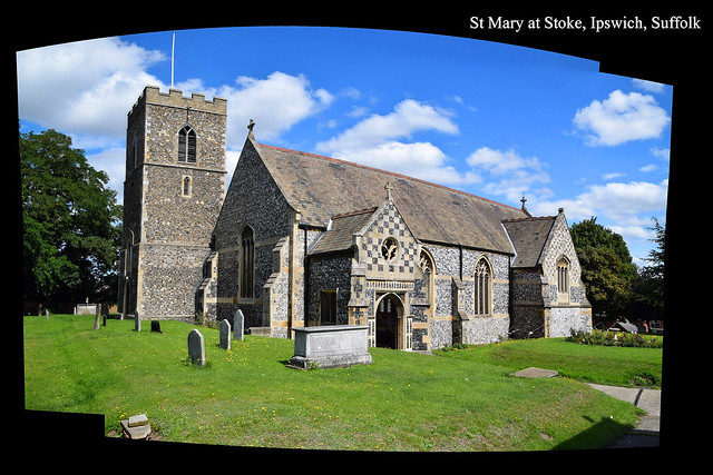
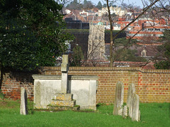
St Mary occupies a site on a dramatic bluff overlooking
the river, across which it faces St Peter, a couple of
hundred metres away. St Mary at Stoke is the only one of
the twelve surviving medieval churches in Ipswich town
centre to stand south of the River Orwell. The church of
St Augustine, which served the quayside area south of the
river, is now lost to us. It was still in use in the
1480s, but all traces of it have completely disappeared.
It was probably about 100 yards away in Vernon Street.
After the Reformation, St Augustine's parish was merged
into that of St Peter, and St Mary at Stoke retained its
relatively rural feel, so close to the heart of the town.
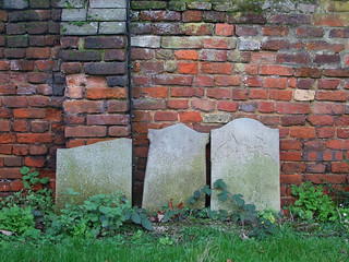
As recently as 1801, the population of the parish was
just 385.
And then, the railways came. The impact of their coming
upon a town like Ipswich, which was already a burgeoning
industrial port, should not be underestimated. However,
the Stoke Hills, as gentle as they are by Northern
standards, proved an impenetrable barrier to the line
from Liverpool Street. Consequently. Ipswich's first
railway station was built in the south of the parish of
St Mary at Stoke, and a mid-Victorian railway town grew
up around it. In the 1860s, a tunnel was blasted through
the hills so that the line could be extended to Norwich,
and a new railway station was built, again in St Mary at
Stoke parish, linked to the centre of Ipswich by a major
new road, Princes Street. By 1871, the population of the
parish had grown to more than 3,000, a ten-fold increase
in less than a lifetime, unmatched by almost any other
parish in East Anglia.
This development needs to be borne in mind when exploring
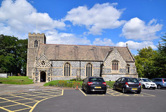
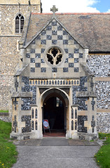
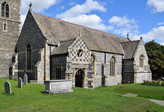
St Mary at Stoke parish church. From the south, you see a
large, blockish Victorian building with flushwork on the
porch and transept, a little characterless otherwise. The
focus is all to the south, the graveyard dropping away
quickly on the other three sides, as if reminding us of
the long tradition here of independence from Ipswich over
the water.
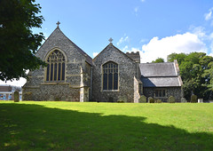
However, walking around to east or west you discover that
behind it there is another church, medieval this time,
and still rural in feel. The tower is at the west end of
the older church, and the two are joined as if
non-identical yet conjoined twins. You step inside to the
impression of two churches joined together, the near one
Victorian and wide, the far one narrower and older. In
fact, this impression is almost exactly right. The
original medieval church is now the north aisle ahead of
you, which is why the tower is off-centre.
 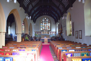
The 1872 nave you step into is the
work of the great Anglo-catholic architect William
Butterfield. This church came 15 years after his
masterpiece All Saints, Margaret Street. And yet, St Mary
at Stoke has nothing like the excitement of that or his
other fine London churches. The chequerboard flintwork on
the porch and transept are perhaps echoes of St Mary le
Tower in the middle of town.
There were two major rebuildings here. The first, in
1864, rather unforgivably destroyed a magnificent Tudor
porch in red brick. This rebuilding, by Richard Phipson,
the Diocesan architect, gave us the huge, austere
transept on the northern side. The intention seems to
have been to increase the capacity of the building while
tarting it up a bit. Twelve years later, Butterfield's
work here was rather more ambitious. He created a large
urban church to the south of the original, the joining
arcade making an aisle of the old nave.
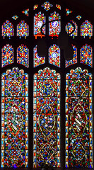
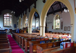
Standing inside the main entrance, everything appears
19th Century, from the font nearby to the grand reredos
with the east window above. But this illusion of an
entirely Victorian building is dispelled if you walk
through the arcade and look up. Here, the north aisle,
which was the original church, retains its medieval
hammerbeam roof. Because of this, the aisle retains a
different atmosphere to the nave, its patterned glass in
the aisle east window a counterpoint to Clayton &
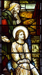
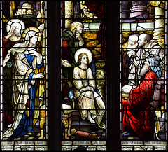
Bell's typically plodding east window to the south of it.
The Heaton, Butler & Bayne glass along the south wall
is better.
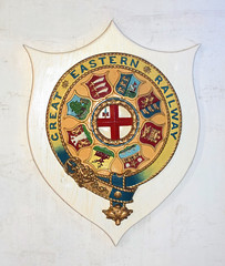
Halfway along the rather stark
north wall is a Great Eastern Railway insignia from a
train, a reminder of the industry which almost
single-handedly turned this parish into an urban one. In
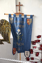
the 20th Century, this church had two chapels of ease in
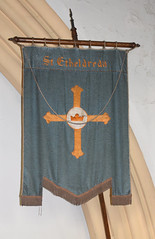
its parish. St Etheldreda was near the railway bridge on
Wherstead Road, and St Edmund was beside the school on
Ranelagh Road. These two churches have now completely
disappeared, but a haunting remnant survives in the form
of St Etheldreda's banner on display in the north aisle.
The population of the parish fell sharply in the years
after the Second World War because of slum clearance
along Vernon Street and Wherstead Road. There was further
large scale clearance of terraced houses and industry in
the 1990s. But the continued redevelopment around the
docklands has begun to redress the balance.
|
|
|